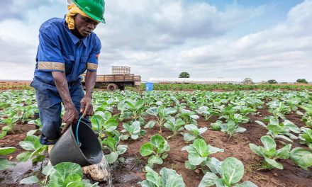
An African NPO combines traditional investigative reporting techniques with data analysis and geo-mapping to help track eco-offences.
South Africa has laws and processes that cater for public participation in the environmental impact assessments (EIAs) needed before most new developments can go ahead, including mining. The problem is that many local residents affected by these developments struggle to access critical information about what is happening – often they have to read about them in small type on notices pinned to fences and trees, or in obfuscated newspaper advertisements.
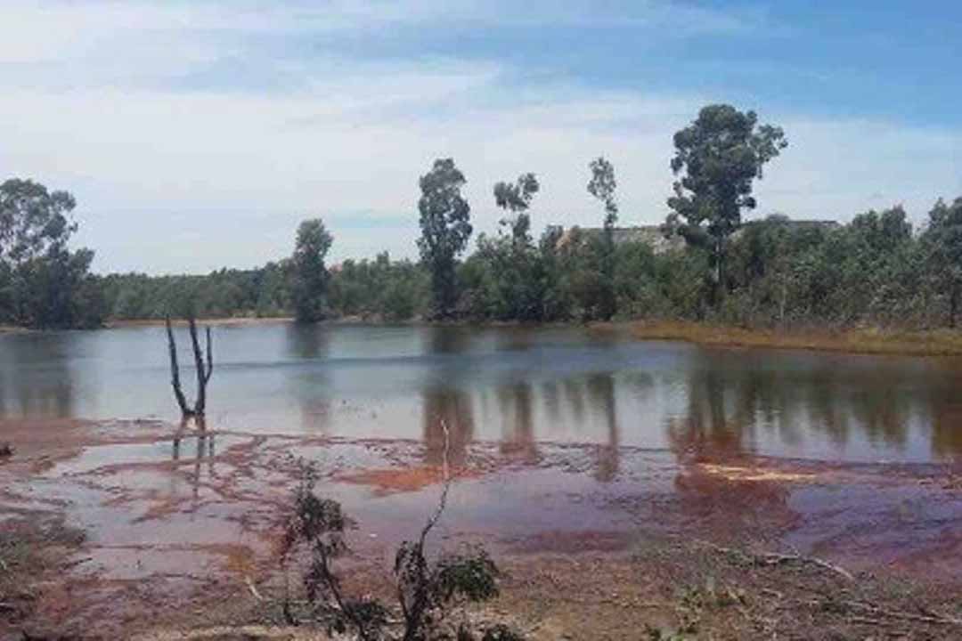
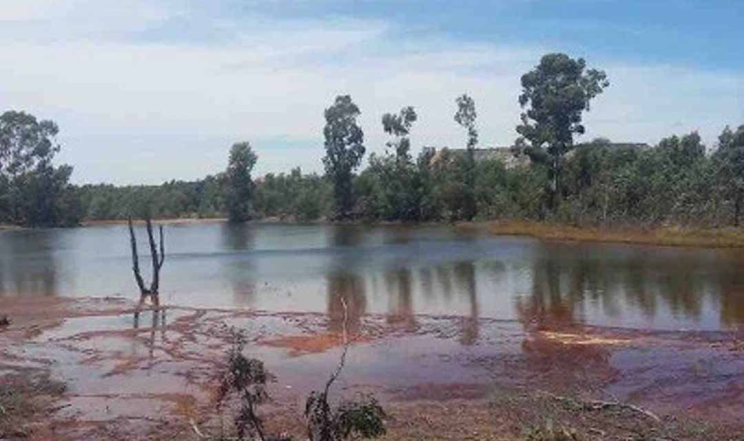
Assessment of eight coal mines in Mpumalanga showed pollution of both surface and underground water resources. Photo: Oxpeckers
At an Editors’ Lab Hackathon in 2013, a team from Oxpeckers Investigative Environmental Journalism, a non-profit organisation that combines traditional investigative reporting with data analysis and geo-mapping tools to expose eco-offences and track organised criminal syndicates in southern Africa, put together an innovative solution: build a digital app that would alert residents to developments happening in their neighbourhood. The app would enable users to search for new developments in their area, give inputs where appropriate, and register to receive alerts whenever new information became available.
This was the start of #GreenAlert, an open-source web and mobile platform that provides citizens with a simple tool to track EIAs and other land-use change notices, and that aims to stimulate public engagement, improve accountability and promote civic engagement through active citizenry. Based on the #GreenAlert project, Oxpeckers went on to build a similar initiative in the mining sector. Called #MineAlert, this app is a centralised tool for users to access, track and share information and documents on mining applications and licences.
The first iteration was launched in April 2016, the second in 2018 expanded the platform to map risks posed to water resources by mining activities, and the third iteration, launched in August 2019, empowers users to track and share water-use licences approved for mining. Both tools are citizen-focused, web-based apps that aim to promote transparency and an informed citizenry. Using location-based email alerts for development and mining applications, they also provide online access to important documents, such as environmental authorisations, and mining social and labour plans.
The ideal implementation of these platforms would be to update the data inputs via an API (application programming interface) linked to the relevant government departments. Oxpeckers are working on this option, and in the meantime populate the tools with data obtained under South Africa’s Promotion of Access to Information Act (PAIA), and information provided by users. Long-term impacts of the extractives industry, such as acid mine drainage, are adding to the problems of drought, water security and climate change across South Africa. Rural communities are usually the first to experience first- hand the negative impacts on freshwater resources.
“Since the platinum mine began operating in our area there’s been polluted water discharged into our rivers. Our livestock drink from there and are dying. Our community is angry,” tweeted one community member, Mathapelo Thobejane, during a recent #MineAlert community symposium. Most communities affected by mining have no prior knowledge that a mine is planned in their area, what the conditions of related permits such as water-use licences are, or how to go about addressing negative impacts. They often don’t know how to seek redress when things go wrong, other than to become angry.
Goals for rehabilitating derelict and ownerless mines are often not met. Water pumped out of these abandoned mines leaches heavy metals, including aluminium, cadmium, iron, and manganese, into nearby water reserves and pollutes the quality and quantity of potable water. With these risks in mind, #MineAlert partnered with South Africa’s Water Research Commission (WRC) to develop simplified, user-friendly maps that pinpoint identified strategic freshwater areas most vulnerable to mining activities. The WRC had collated data on water systems, geology, mining activity and ecosystem vulnerability around South Africa, and built models to estimate risks posed to freshwater resources.
#MineAlert translated this complex data into a series of heat-map layers that provide instant visualisations of the risks to freshwater sources and ecosystems posed by mining activities. The visualisations span all mineral provinces, with a greater level of detail in areas where mining frequently takes place. As a country that is considered to be one of the driest countries per capita in the world, South Africa depends greatly on its strategic water source areas. These are natural “water factories”, supporting growth and development needs that are often situated far away.
Strategic water source areas (SWSAs) cover just 8% of the country’s surface but supply 50% of the annual runoff, according to the WRC. They supply 50% of the population with water, 64% of the economy and about 70% of the water that is used by agriculture. Although 21 SWSAs have been identified, only 11% of them receive formal protection. The #MineAlert Mining your Water map layer, launched in August 2019, drills down into granular data on priority freshwater resources to investigate the impacts of mining on those.
It pinpoints where water-use licences granted for mining project are situated in SWSAs – and shares the conditions that apply to the licences. Knowing what conditions and guidelines mining companies should adhere to in terms of water-use regulations is a useful way of tracking and understanding the impacts of mining on water resources, and of holding the companies involved to account. The need to monitor water-use applications and licences was emphasised by a recent Oxpeckers investigation that exposed sweeping water permit violations at mines across South Africa.
Based on data shared in parliament by the Department of Water and Sanitation, the article showed a radical increase in the number of mines flouting water-use regulations. The data Oxpeckers uses on its digital platforms is aggregated and analysed in journalistic investigations. For example, in 2015 Oxpeckers investigated whether the mining industry in South Africa was abiding by the undertakings that companies, by law, make to rehabilitate mines that are no longer in use.
Drawing on the mining licences data shared on #MineAlert, and working with other Oxpeckers team members, journalist Mark Olalde sourced and collated data on mine closures and the financial provisions for rehabilitation of end-of-life mines. He spent 21 months pestering government departments for information, formally submitting requests under the PAIA and travelling from pillar to post to secure the data. “Thursday mornings were for sitting in the office with a cup of freeze-dried, instant coffee,” Olalde recalls.
“#PAIAday, as I called this weekly ritual, was my method for prying as much formerly secret information as possible from the country’s Department of Mineral Resources (DMR) into the public domain. Between sips of coffee, I would call/email/pester every provincial DMR office on my list for the week.” Olalde then curated and analysed the datasets to produce a series of investigations on mine closure trust funds, financial provisions for rehabilitation and closure certificates, starting with ‘Mine closures: What’s happening in your backyard?’.
His second investigation, ‘Coal mines leave a legacy of ruin’, revealed that since at least 2011 no large coal mines operating in South Africa had been granted closure. This means the mines have not been rehabilitated and were simply abandoned, leaving a legacy of local and global pollution. The third and final investigation, ‘R60-billion held for mines that are never closed’ exposed “a failed system of mine closure in which there is little oversight, large mining house carry the brunt of responsibility for financial provisions that are never used and mines that are never fully closed”.
This work on mine closures not only liberated previously unseen datasets but has been discussed during parliamentary committee meetings and has resulted in the government amending the regulations pertaining to Financial Provision for Prospecting, Exploration, Mining or Productions Operations. The revised regulations will repeal and replace the Financial Provisioning Regulations of 2015 and include changes in the calculation of financial provisions.
The Department of Environmental Affairs is drafting new regulations to govern financial provisions for mine closures that could fundamentally transform how clean-ups are funded. Previously governed by the Mineral and Petroleum Resources Development Act, financial guarantees and other aspects of mine closure now fall under the National Environmental Management Act. The new regulations come with more stringent requirements for transparency, including for auditing financial provisions, which are proposed to occur every three years and to include “independent specialists”.
Will rising temperatures make some areas uninhabitable for animals and humans? Will today’s coastal towns be under water in future? These are the type of questions scientists all over the world are trying to answer by predicting how local climates and the global climate will change over the next decades. Climate modelling is a complex science. Carefully generated algorithms that try to consider all the variables are fed into powerful computers that calculate how climates might change. The variables that influence the climate include things like how cloud cover affects sunlight penetration, how air flows over mountain ranges and across oceans, how the sun heats up different parts of land and sea at different rates, and how much pollution is in the air over different parts of the world.
Oxpeckers set about demystifying the science with ClimaTracker, a geojournalism tool that uses interactive maps and journalism to make complex climate modelling easily accessible. Its aims include working with civil society and government entities to inform vulnerable communities and to assist in strengthening their responsive capacity by reporting on both good and bad adaptive practices for building resilience.
Using heat maps based on climate modelling data generated by researchers at the Council for Scientific and Industrial Research (CSIR), ClimaTracker features a temperature timeline that shows how much average temperatures have changed and are likely to change in the future. Farming maps, based on a climate model called ACRU developed by Professor Roland Schulze at the University of KwaZulu-Natal, show how these temperature increases will affect the average yearly primary production in different parts of South Africa over the next 100 years.
Food security is one of the biggest worries associated with climate change; what do rising temperatures and changes in agricultural production mean for the average household? Oxpeckers has created the ClimaTracker Food Basket Calculator to show the costs of climate change in real terms. The tool offers a gamified user experience that brings the message home by letting users calculate and compare their average food basket costs from year to year. Users select items they are most likely to purchase in a shopping trip to get an idea of how much crop and animal product costs have increased, or decreased, over the year.
All this information is useful for journalists reporting on climate change, adaptation and food security. Again, using and linked to the data that powers the platforms, Oxpeckers created and published a series of related journalistic investigations.